Kokopelli’s Trail: Day Two
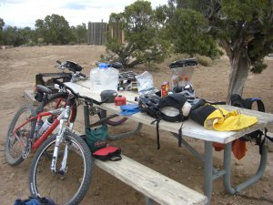
One of the great things about camping out is waking up to the early morning sun streaming in through the fly of your tent. If you happened to go to sleep before dark the night before, then you can get up at the crack of dawn and still bag better than 10 hours of sleep. The canteens and Powerade® we’d stashed the previous morning were just enough to fill our Camelbacks® and Pete’s 2 water bottles. Pete had planned for a cold breakfast, but I needed to boil some water to make my instant oatmeal. Unfortunately, I’d already combined the water and Powerade® in my Camelback® , so I boiled about 1/2 cup of dilute Powerade® , mixed it with my strawberry oatmeal, and added some fresh raisins for a truly unique breakfast. Our neighbors stopped by with a coffee peace offering that I gladly accepted, and we chatted a bit about mountain biking and touring. It was a delightful diversion, but we were anxious to get underway. The weather was looking much nicer (read hotter, as well) than yesterday, and our plans called for about 40 miles of riding from Bitter Creek to Dewey Bridge.
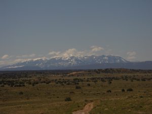
The previous night, we were pretty sore. Pete was a bit worried that he might not recover well enough for the next day’s ride. I wasn’t worried about my legs, but I had some concern for my sore rear. But we both slept great, and aside from a pair of tender backsides, we were just fine. The day started with a nice stretch of slightly downhill dirt road. It was smooth sailing for several miles. We were at least doubling our rate of travel from the previous day, and still we managed to shoot way too many pictures and what I later discovered to be gigabytes of goofy video clips. After about 30 minutes of riding, we got our first glimpse of the La Sal mountain range. It looked so far away, it was hard to imagine we’d be arriving there the next evening. A few minutes later, we were finishing up our first section of pavement through a lush irrigated valley leading towards the Westwater access point for boaters on the Colorado. Just after passing under some railroad tracks, we made a left-hand turn. It was pretty, but after about a half mile, Pete and I both felt we were heading the wrong way. We pulled out the map, and after a quick consultation, it was confirmed. We were indeed going the wrong way, and it was slightly downhill to boot! As we were turning around, a train passed by on the tracks, so of course I shot a little video.
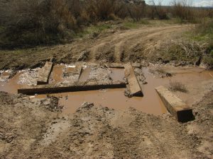
This continued for a while until we reached what proved to be the morning’s technical crux: a small “stream” crossing with what might, once upon a time, have been a bridge. It was easily handled, and soon enough we crested a small rise to discover an unexpected view of the Priest and Nuns formation in the Castle Valley. Like the La Sals, it too seemed very far off, but the picturesque towers were unmistakable. Between the mountains and the desert towers, it really seemed like we were heading towards Moab.
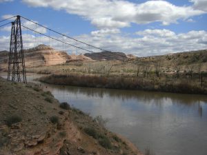
In terms of mileage, this was probably the longest day of the trip, but most of the tread was was on dirt roads and technically quite easy. It was also generally downhill, so we were making great time, especially compared to the previous day’s 5 mph crawl. We kept rolling over little hills—playing hide-and-seek with the mountains. We knew we were getting close to the Colorado river, but when it finally appeared, it was a bit of a surprise.
Along the river, we were rewarded with a few miles of actual singletrack. It was an oddly lush stretch of trail with tall grasses and junglesque plants tightly lining the trail. I was in the lead, and swept the path clear of cobwebs for Pete. I hate cobwebs! All too quickly, we reached the end of the rideable singletrack and faced a bit of hike-a-bike to reach another stretch of dirt road. Again the hiking was challenging, with the heavy panniers attached to my bike. By this point, it was after noon and the day was getting pretty hot. I don’t recall the temperature, but I was really chugging through my day’s water supply.
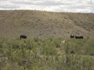
Back on the road, we traveled through a few more rolling hills and an open cattle pasture that was loaded with baby cows. The little calves are so cute. I like that they’re so young they actually run around. When is the last time you’ve seen an adult cow run? While the calves drew our attention, we drew the attention of several protective heifers. After a few pictures, it was clear we should move along before they got really angry with us.
After another mile or two of dirt road, we again arrived at some pavement. Shortly, we were standing at the first junction with Utah highway 128. We traveled along the highway for about a half mile before coming to the Yellow Jacket canyon section of Kokopelli’s Trail. I was starting to get tired, and the upcoming section (about 8 miles long) promised to be somewhat challenging with one good-sized climb in the middle. According to the map, it also offered some scenic riding—passing near a couple of unnamed arches and Fear and Loathing tower. I pulled out my Camelback® bladder and discovered that I had about a cup of water left. It was hot, and that didn’t seem sufficient. Since we’d planned to filter some Colorado River water for dinner and the next day’s riding, we decided to ride the highway for 4 miles to camp. After setting up camp, we’d grab a snack, top off our water, and head back out (sans gear) to enjoy an unencumbered ride through the section we’d just skipped.
The little campground by the old Dewey Bridge was just about packed. There was just 1 site left when we arrived, so I guess it’s a good thing we took the small shortcut. Arriving at the campground, I realized for the first time that I’d overlooked paying for the night’s camping. Pete had 8 bucks in his wallet, but the fee was listed at $12.00. We made a good faith gesture, and stuck $8.00 into the self-serve envelope, but there wasn’t a pen/pencil to write on either the envelope or the little the stub you’re supposed to place on the post at the campsite. We also lacked a car to park in the parking space. This wasn’t lost on the other campers, who seemed to realize we were a bit light on gear. They offered us beer and a whole cadre of food items, but we turned down the generous offers. In hindsight, I should have accepted a beer.
While Pete struggled to find enough rocks to set up the tent, I went off to the boat launch where I figured it’d be easy to sit by the river and filter enough water to fill all of our containers. The first canteen went by pretty smoothly, but as it was nearing full, I felt the pump getting a bit harder to operate. Suddenly, the hose shot off the top of the filter, spraying water all over my shirt and face. At that point, I transferred the “clean” water to the small-mouth canteen so that I could resume filtering the river. I reattached the hose, and started slowly filtering the water. The hose bulged from the high pressure with each half stroke, and the whole process grew agonizingly slow. By the time I had the second canteen about half full, Pete appeared. He pointed out the the tube appeared to be developing an embolism! If I held the filter and canteen perfectly straight, you could hear a faint trickling sound with each stroke. The canteen was now filling so slowly that this was the only indication that water was still passing through the filter.
While I could probably have gotten more water through the filter, it was becoming almost impossible to operate the pump. I had to keep one hand on the hose to keep it from shooting off the top of the filter while simultaneously pumping with the other hand. We were both growing increasingly nervous about our supply of water. At the moment we had about enough to fill our bladders, but we were already dehydrated, and we hadn’t cooked dinner or tomorrow’s breakfast. The next day’s ride was relatively short at only about 35 miles, but it included 2 major climbs of about 2,000′ and 3,000′ respectively. Back when we were leaving Boulder, the weather forecast was for increasingly hot temperatures throughout the trip. Given our dire water reserves, we grudgingly decided not to backtrack for the Yellow Jacket Canyon section of the trail.
Both Pete and I had planned on bringing a deck of cards. Pete pulled his out to save a little weight at the last minute, and I forgot to grab mine from the cupboard as I was leaving the house Thursday morning. The cards would have come in handy while we sat around camp in the early afternoon with little to do. We had an early dinner and were about to turn in for the evening when we struck up a conversation with our neighbors. It was clear that we needed more water, and there wasn’t really any alternative but to play upon their sympathies. They were super nice, and offered up enough water to top off our bladders and Pete’s water bottle. Personally, I felt much better thinking I might at least have enough water for the coming day’s ride. Our neighbors were 3 couples with about 5 children between them and a few dogs to boot. Pete is anxious to start doing some car camping with his wife Kelli and their new daughter Marin, so he asked for some pointers. We exchanged a few short stories of our previous days of riding, and learned that one of the couples had just moved to Denver from Nebraska. It reminded me of when Jess and I had arrived in Colorado and how exciting and new everything seemed.
Shortly thereafter, we made last trips to the restroom, brushed our teeth, and headed off to bed. We chatted for a while, and I listened to some Chuck Mangione with just one ear-bud. It was the Live from the Hollywood Bowl LP, and Pete could only hear the flugelhorn. He thought it sounded like mariachi music, and contracted an earworm that I suspect didn’t Feel(s) so Good.
2 Comments
GregBrinkman
Good descriptions. I can’t even imagine how sore my tender rear would be if I attempted this.
GregBrinkman
Good move leaving the cows alone. I was charged by some adult cows in Utah once (they turned away before turning the wilderness into a mini-Pamplona) – those cows that survive in the desert are a lot scarier than the slowpokes in Indiana.