Backpacking the Lost Creek Wilderness
Last weekend, Jess I and set off for a little backpacking adventure in Colorado’s Lost Creek Wilderness. I’m a terrible backpacking trip planner, as I never seem to know where we should go. The day before the trip, we were out at the bookstore and REI pouring over a serious stack of guide books. Of course, most are hiking guides and detail fun-sounding yet relatively short trips. We didn’t want to head up to Rocky Mountain National Park, because we’d have to pay both entry fee and permit fee. It’s much nicer in the winter when the crowds are gone, you can self-register for free, and avoid entry fees by getting up before the gatekeepers!
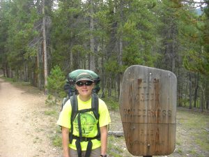
Finally we settled on a nearby stretch of the Colorado Trail. For those of you unfamiliar with it, the CT is a pretty long trail. While shorter than the big 3 US trails (AT, CDT, and PCT), it stretches from Denver, East of the Rockies, to Durango in the middle of the beautiful San Juan Mountains. In total, it’s almost 500 miles long, and makes neither a straight nor low-elevation trek from Denver to Durango. Most of the trail is open to mountain biking, and in my opinion, the CT makes for some of the finest mountain biking in the country (I’d say world here, but I’ve not yet ridden the Alps or Canadian Rockies, so I don’t want to go overboard).
For this trip, we selected one of the few sections not open to mountain biking. This made sense, as backpack and horseback riding are the only ways to explore wilderness (with a capital W) areas. While we’d wanted to leave Friday evening after work, our last-minute planning forced us instead to opt for a Saturday morning start. That would mean just a single night of camping. With such a short trip, I was looking for any way I could possibly make use of my considerably smaller Osprey pack. Not only is the Osprey much smaller than my monster Gregory, it’s probably several pounds lighter as well. It was never meant to be an expedition pack, but for short trips, it carries a moderate load surprisingly well.
We ended up splitting the gear with Jess taking the relatively light but bulky tent. I grabbed the denser stakes and pole (just 1 for our unusual looking Marmot Area 51 tent) as well as the camp kitchen. We both took along rain jackets as the forecast called for a moderate chance of thunderstorms on both Saturday and Sunday. I think Jess’s pack was still a bit heavier, though, as she tends to bring too many changes of clothing. All I had with me was a pair of long pants, a heavy shirt for the evenings, and the aforementioned Gore-Tex. We both schlepped pack covers too, as an added insurance against serious rain.
Because we weren’t planning a long hike, we slept in a bit on Saturday morning. It’s only about a 90 minute drive to the trailhead outside Baily, CO, from our house, and we wanted to grab some cheap and delicious breakfast from Santiago’s before leaving Lafayette. We also grabbed a cup of coffee from the local shop, and Jess watered the garden while I checked e-mail. We were on the road by about 10:00, and we left the trailhead at about 12:30, just after I repacked my little backpack for the 3rd time. I guess everything fit okay, if you don’t take exception to me strapping the sleeping bag and pad to the outside of the pack!
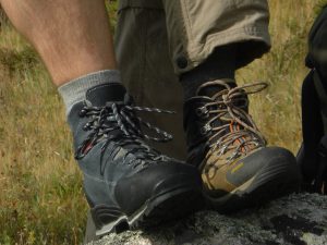
Neither of us had been backpacking all year, so it was nice to finally get out away from all of the roads for a while. We also had an ulterior motive. Both of us had new boots! Jess got hers at an REI garage sale. They were a pair of used Asolo boots for $25.00 that were a miraculously good fit. There’s a wee bit of damage along the one cuff, but otherwise they’re in excellent shape. My new pair are Kayland’s (same brand as my old boots) that were the last pair of old stock at the outdoors store in Leadville. I’d actually been looking to try these boots on for about a year, but there are relatively few stores stocking these Czech boots. Maybe they don’t fit everyone as well as they fit me?
About 30 minutes into the day’s hiking, we crossed into the Lost Creek Wilderness. Our original plan was to just go out and back along the CT as far as we felt like going; however, as I was glancing at the map in the car, I noticed what seemed like a doable loop route. I must say, I really like loops far more than out and back hikes. You get to see something new the whole time! Since I hadn’t measured out the loop option ahead of time, I grabbed some 2.5 mm spectra from the glove box and quickly traced the route. It’s a rough measurement, but I figured it was about 24 miles. It also appeared from the map that the best camping sites would be right about the halfway point in what appeared to be a lovely meadow with a stream running through its length.
The section of the Colorado Trail that crosses the Lost Creek Wilderness from around the Wellington Lake Road heading west is actually rather boring. I hadn’t realized this during the research, but it’s obvious that we spent most of the first day hiking along what once was a spectacular road through the mountains. This road was obviously a victim of the Wilderness Act and was in such good shape (aside from the occasional sapling) as to still be generally passable by a little car like Taco. Of course, it did make for easy travel for the opening several miles of gradual uphill hiking.
By about 3:30 we had encountered all of about 7 people. We were just about to turn off from the abandoned road and onto a real footpath that would switchback to the day’s high point before descending to the little meadow where we hoped to camp. We’d passed 3 bow hunters out for the day and a family of four that appeared to be backpacking. They were filtering water by the only stream we’d crossed.
Another hour later, we were making steady downhill progress towards a trail junction that would take us through the meadow. You could see the meadow coming into view through the trees off to the left, and I had to fight back the temptation to bushwhack a shortcut. Jess, on the other hand, had no such temptation. She was starting to get pretty tired, and my feet were beginning to hurt a bit. Perhaps I should have opted for a thicker hiking sock!
Still heading down, we popped out of the trees with a wonderful view of the meadow just as we came across a pair of backpackers enjoying dinner in front of their tent. They were practically camped on the trail, but I must admit that there weren’t a plethora of good camping areas along the route. We chatted briefly and indicated that we were trying to make a loop of the section we’d both just hiked with a couple of additional trails. They were continuing on in the same direction the next morning. I didn’t envy their spot, but I was ready to stop for the night.
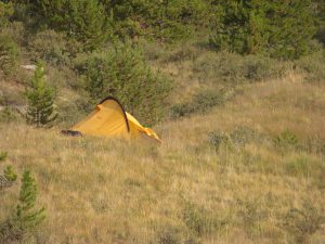
In order to cross the creek and intersect with the next trail, we had to head quite a ways farther west than had appeared to be the case on the map. Nevertheless, we eventually made the intersection, crossed the creek, and started back up the meadow on the opposite side of the forest. After about an hour of easy hiking, we’d covered about 2.5–3 miles and were now straight across the meadow and around 500 yards from the backpackers we’d passed earlier. Another 45 minutes of hiking, and we’d come to what seemed like a reasonable stopping point for the day. I’d hoped to get a little farther, but it was nice to set up camp with some daylight left, and it made cooking diner much easier.
We scouted out a nice flat spot for the tent just where the meadow met the forest and high enough above the creek as to feel safe from any possible flash flood. I finished putting up the tent while Jess headed up to a nice rocky outcrop to start boiling water for dinner. We dined on a lovely spaghetti with meat sauce we inherited from Pete and Kelli (bought pre-Celiac Disease diagnosis) and some instant garlic mashed potatoes. If we’d not hiked some 9 miles, it’d have been a disgusting amount of food, but as it was, we had no trouble shoveling it all into our tummies. After dinner, we hiked down to the stream to refill our water bladders with the filter I’d schlepped for just this purpose.
While we were eating, it started to rain lightly. We both donned our jackets, but it was relatively dry under the edge of the forest canopy. Our tent, on the other hand, did get pretty wet. Unfortunately, it would remain just as wet the rest of the trip. One peculiarity of the Marmot Area 51 is its phenomenal size to weight ratio. It’s only around 6 pounds with the pole and stakes, but being a single wall tent without waterproof/breathable fabric, it performs poorly in high humidity (think rain). It’s totally waterproof, but it gets very clammy and stuffy. Occasionally you’d think it would be better to be out in the rain. I spent the night sleeping poorly. I was either way too hot and sweaty in the sleeping bag or too cold and damp outside the bag, and the inside walls were soaked from all of our sweat condensing on the cool fabric. There were sounds of distant lightning all night, and the morning couldn’t come soon enough!
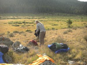
The next morning, we boiled some water for instant oatmeal with craisins and tried to dry our all of our gear. I laid everything on some rocks as the tall grasses of the meadow were still wet from the previous evening’s storm. By the time breakfast was done, we had everything pretty dry except for the tent. Luckily, we wouldn’t need it again, so Jess stuffed it into the bottom of her pack after we shook off as much of the water as possible. Within about 10 minutes, we were back on the trail and making progress back towards the car.
The little connector trail we were on was skirting the west side of the wilderness. By about 9:30 in the morning, we came to a little forest service campground that we had to cross to connect with the Wigwam trail. Many of the campers weren’t yet up, but those that were tended to be in the middle of cooking some yummy smelling breakfasts. I was especially jealous of the coffee and bacon I could clearly smell wafting from their sites.
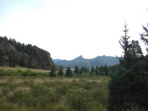
The Wigwam trail is nearly pan flat for miles as it traverses what is actually a massive meadow in the midst of the Lost Creek Wilderness. There are cool granite rock outcroppings all over the meadow—many of which would offer some fun little climbs for the intrepid climber. Early in the hike, we started encountering all sorts of backpackers. Most were close to the trailhead in the little campground, but a whole group of what appeared to be scouts were much farther into the heart of the meadow. By around 11:30 we stopped for a little lunch on the far edge of the meadow. According to the map, we had to climb up a series of switchbacks to a saddle between this meadow and another meadow on the far side of the saddle. Our route would then turn north along the Rolling Creek Trail and ultimately reconnect with the CT near where we’d left Taco the previous day.
The switchbacks were relatively easy, and the trail continued past some beautiful little beaver ponds. We passed a few fishermen, but didn’t inquire as to the the quality of the fishing (sorry Greg and Emily). Nevertheless, if it matched the quality of the scenery, it would be far above average! We paused again for a little snack at the next trail junction. According to the map, it was a modest 850 feet or so of elevation gain followed by a downhill race to the finish.
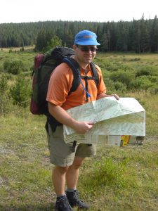
At the time, I was blinded by the modest overall elevation gain, and totally missed the rate of ascent/descent. Jess thought I did a great job of navigating throughout the trip, but I shouldn’t have botched this assessment. The next four miles were absolutely brutal. I think the downhill was even worse than the climb! Having hiked this section of the Rolling Creek Trail, I can’t help but wonder what possessed a person to blaze a trail over this particular shoulder. Sure, it wasn’t very high in elevation, but the trail is very steep in spots and barely has room for any switchbacks to lessen the climb. It pretty much marches straight up a creek and over the shoulder to meet up with Wigwam trail.
Of course, the scenery was still quite gorgeous, and I might not have been as negative on the trail had I been less tired. We were already around 8 miles into the day’s hike when the uphill portion began. My feet were killing me. All of the harsh landings working our way down from the high point were really adding up. I didn’t feel any blisters coming on, but instead felt like I had bruised the entire balls of both feet!
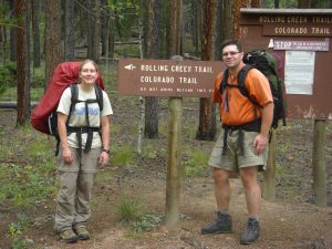
Eventually, just as the map indicated, the rate of descent mellowed, and the remainder of the return hike was pretty mellow. Just after crossing back out of the Wilderness, we again spotted some mountain bike tracks. We saw these telltale signs of riders just about everywhere outside of the wilderness. Unfortunately for Jess, a blister she’d been sensing burst around a half mile from the car. We stopped again to get a short rest, then marched on to our finish. In total it was a little more than 23 miles of hiking with around 9 miles on the first day and about 14 miles on the second. Most of day two was easy, except for the hill in the middle, and even that might have been far easier if we’d encountered it earlier. I’m not sure I’d recommend the section of the CT nor the Rolling Creek Trail, but the Wigwam Trail was quite nice. Perhaps we’ll work a different loop variation using the trail with some of the more southern alternatives. According to various Internet sites, there are over 140 miles of trail within the Lost Creek Wilderness, so we’ve got quite a few left to explore.

3 Comments
GregBrinkman
Cool trip. I’ve heard that wilderness is full of little brook trout – we’ve always wanted to check it out. We went for a hike there last year but didn’t make it all the way to the stream we wanted to fish. It’s nice to know it doesn’t sounds too crowded – I guess because there are no 14ers!
Kelli
You two are very brave!!! new boots AND 24 miles of hiking
Sounds like a great trip.
Pingback: