Lost Creek Backpacking, Take II
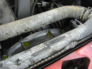
As you no doubt recall from Jess’s recent post, Phoebe’s uncle Matt and aunt Erin were out for a visit. We had a wonderful time introducing her to them, and thought a short trip over the holiday weekend would be a great way to introduce Phoebe to backpacking. Since we’d had a great time backpacking in the Lost Creek Wilderness last summer (technically Phoebe’s first backpacking adventure), we thought we’d return. We were also looking for something relatively close to home. Unfortunately for Taco, the Lost Creek wasn’t quite close enough. Just after turning onto highway 285 outside Golden, the temperature gauge began to climb. By the time we managed to get the car off the road, steam was billowing from the hood, and the tell-tale signs of a coolant leak were staining the engine compartment a lovely iridescent green color. Luckily we were traveling with two cars in order to facilitate a shuttle route option, so we coalesced into Erin’s Honda and called Matt’s savior (AAA) for a tow. The tow truck arrived pretty quickly, and dropped the car off right in our driveway. After the short diversion, the trip was on.
This time we were headed to the wilderness’s namesake trail (Goose Creek, AKA Lost Creek, Trail). We somehow missed the dirt access road and ended up blowing right through Deckers, CO. It wasn’t until we saw signs for Douglas County that we realized we were pointed in the wrong direction. At least it wasn’t Lincoln, Nebraska, like in Dumb and Dumber. A little route correction, and we were back on our way.
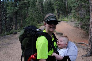
When we arrived at the trailhead, there were already several cars present, and one large group was just about ready to set out onto the trail. I’d seen from the Internet that it was a popular trail, so I wasn’t totally surprised; however, it was still early on Friday afternoon. We all piled out of the car, stretched, and answered nature’s call before pulling on our backpacks and adjusting the straps. We even gave Phoebe a fresh clean diaper, but that was mostly for our benefit! I think it was about 3:30 by the time we left the trailhead. Jess was carrying Phoebe in the Baby Bjorn along with my light backpack stuffed with some clothes and all of Phoebe’s accouterments. I had the great big Gregory Denali stuffed with two sleeping bags, the tent, the water filter, a small gas lantern, two days worth of food, some dishes, and all of my clothes. I also had two sleeping pads strapped onto the sides. All together it wasn’t too bad, and the Gregory really carries monster loads pretty well—often better than the wearer!
After filling out the free self-serve permit at the registration we were off on our real adventure. The first part of the trail passes through a section of the wilderness that burned back in the Hayman Wildfire of 2002. There were charred, black tree trunks everywhere and a few lovely wild flowers growing up in the scorched forest. From the images I’ve seen, we were likely a couple of weeks too late to see the flowers at their peak. After just about a half mile, we crossed Goose Creek on a little metal bridge and left the burn remnants behind us.
The trail was nearly flat as it continued to follow the creek for about a mile or so before climbing up and out of the valley. As we gained elevation, the views really opened up. The landscape is pretty interesting with little domes and spires all around us. Much of the rock was reminiscent of Vedauvoo in Wyoming. At several occasions I’d wished we’d brought some climbing gear, or at least a crash pad and some rock shoes. There seems to be enough bouldering potential to keep a small army busy for months.
Since we no longer had the shuttle hike option, we were now set on the out-n-back route. There was a loop alternative, but we’d pre-determined that the 18 mile loop was too much for two days of backpacking with a baby. After all, this was supposed to be a fun trip, not a death march! Based on that reality, our itinerary was to hike as far as we wanted with the plan of visiting the “shafthouse” and cabin remnants from the 1891-1913 attempt to dam Lost Creek by the Antero and Lost Park Reservoir Company. I spent a few minutes trying to dig up some additional background on the abandoned reservoir project, but there is scant info on the web. All I can tell for sure is that they attempted to pump concrete into one of the sumps where Lost Creek disappeared into a pile of large boulders near the convergence of Goose Creek and Refrigerator Gulch. It seems to have been a relatively large operation with at least 3 good sized cabins housing the employees. But the would-be dam never held water, and the site was eventually abandoned. Good for us, but bad for the Lost Park Reservoir bond holders.

Along the Goose Creek Trail we passed dozens of well used campsites. Most, being either too close to the trail or the creek, or in some cases both, weren’t technically legal sites; nevertheless, they were very well worn, and additional damage seemed unlikely. Regardless, we found a spectacular, and legal, site a little more than 3 miles into the hike. It wasn’t hard to find, as a small, but well worn little trail led back to some level tent spots adjacent a lovely fire ring of found rocks with pre-arranged log seating. We could have gone a bit further, but it was literally irresistible.
We set up camp for the night and set about preparing some dinner. Jess and I split a tasty curry courtesy of Matt and Erin. After rigging up the most ineffective bear bag I’ve ever seen (Note: the bag proved
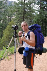
adequately effective but likely just because there were no critters in the general vicinity), Matt and I headed down to the creek with the filter and all of our bottles in hand to fetch more water for the coming day. The dry stream bed we followed to the creek turned out to be a bit of a bushwhack, but we made it in about 10 minutes anyway. Matt did his best Ansel Adams imitation while I pumped a few liters of water. Somehow I ended up with the worse job! We even saw a small trout swimming alongside the filter inlet. I’d guess it was around 5 inches. Matt tried to get a photo with his new waterproof camera, but he kept getting nice shots of a submerged log instead. There was a fish there, honest!
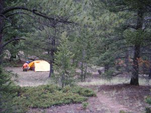
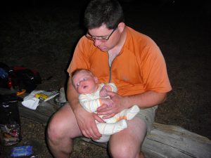
For the return trip, we just wandered in the direction of camp. Despite being uphill with a big load of water, it was much faster and easier without the bushwhacking. As we approached camp, we discovered that Jess and Erin had a nice little fire going. We sat by the fire and threw back the beer (Sunshine Wheat in backpacker-friendly aluminum cans) I’d schlepped all day until the terribly late hour of 8:30 (or thereabouts). It was starting to look like rain and was nearly Phoebe’s bed time, so we packed everything up, thoroughly doused the fire, and shuffled off to our tents. I retold Phoebe the story of Goldilocks and the three bears, but neither Jess nor I could remember how it ends.
Not long after getting snugly into our sleeping bags, the rain started. It lasted until about 1:00 in the morning, but the ground was almost completely dry in the morning. Phoebe woke up a couple of times in the night for a little snack, which worked out well because Jess didn’t need to pump the following morning. Good work, little girl!
The following morning we cooked up some instant oatmeal and stuffed our essentials into our day packs. Without carrying all of the gear for the family, I was able to carry Phoebe in the Baby Bjorn. We tried her facing out, and she seemed to do pretty well. We experienced nothing like the circulation issues we encountered the last time we went hiking. The trip to the cabins was pretty quick. Despite having been abandoned almost a century ago, they’re in pretty good shape. One has a magnificent stone chimney in almost perfect-looking condition. You can see the remnants of a few steel bed springs (badly rusted, of course), some woodburning cooking stoves, and various other odds and ends. The roofs no longer appear leak tight, and the doors and windows are just openings, but it doesn’t appear that it would take too much to make them cozy again.
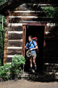
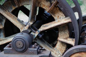
We spent quite a while taking pictures and wandering around the cabins before marshaling for the final 1/4 mile hike to the “shafthouse.” In reality, the only real remnant is a big rusted winch that they must have used to pull boulders and rock out of the would-be-damn site. It’s interesting, because it appears to have been water powered. You can see where the fittings for the water delivery should have been attached. There’s also a single section of an old penstock system or water pipe. It’s unclear where the water to drive the winch must have come from, but I’m guessing most of the residual material was hauled out years ago for salvage.
A short distance farther upstream, you encounter a rickety old metal ladder leading down some boulders that could probably be safely downclimbed. We didn’t proceed, but next time, I’ll plan on continuing and trying to reach the sump. Maybe it’s the caver in me, but I think it’s neat to watch whole streams disappear underground.
After taking a ridiculous number of photos, we packed up and headed back to our campsite to collect the rest of our gear. By the time we returned, everything was nicely dry, so we packed up and prepared to hike back to Erin’s car. There was one Sunshine Wheat left, so I polished it off (hey, it’s hydration and energy). Don’t worry; we packed out all of our trash and recyclables. The return hike went by pretty quickly. There was a short uphill section back to the high point followed by a couple of miles of flat to downhill hiking. We stopped back by the bridge over Goose Creek to dip our toes into the cold water. Phoebe dipped her toes as well, but much like her bedtime story, found it to be too cold!
A few more minutes of hiking (and several more pictures) and we were back at the car. By this point (now Saturday) the parking lot was literally in overflow mode with cars parked all along the dirt road just before the parking lot. There was even a driver patiently waiting on us as we were packing up for our parking spot. Despite all of the foot traffic, the wilderness was generally pretty clean, and after leaving the trail behind, we saw and heard no one from our cozy campsite. I know we took too many pictures, because I had around 2 GB of stuff on the Nikon when I returned, and Jess had another 100+ photos on the little Casio. We exchanged pictures with Matt and it required emptying the USB memory stick and refilling to copy over all of the photos. I guess that means it was a fun trip and one we’d highly recommend (if you’re in Colorado, of course).
3 Comments
Dulcie
You guys are hardcore.
Erika
Sounds like a great trip… minus Taco’s demise. I think that Goldilocks falls asleep in the bed that is just right and awakes with a fright when the three bears return. She runs away in the PG version but I’m sure she must have been eaten in the original! We also had difficulty telling Genevieve the story of the tortoise and the hare.
Russ Lehman
The winch at the “shafthouse” was steam powered. There is (or was, the last time I was there, a few years ago) the remains of a boiler nearby. I don’t know whether the use wood cut in the vicinity to fuel it, or hauled coal in. Most likely wood, since it was available nearby.