Kokopelli’s Trail: Day Three
On the third day, I rose with the sun and spent several minutes taking pictures of the sunrise. The previous night had been the coldest, and I found a little frost on our bags. After a quick trip to the bathroom, I pulled the sleeping bag from the tent to dry it on a rock before putting it back into the stuff sack. I used a little more water (without the diluted Powerade®) to cook another tasty bowl of oatmeal for breakfast with some more fresh raisins and sat down with the map to look over the day’s ride. I had to bring two different topo maps to cover the entire trail, and this morning I was exited to put away the first map for good.
We only faced about 35 miles of riding for the day, but there were two huge climbs. Either would have been sufficient to top our previous days’ cumulative elevation gains, and it was forecast to be even hotter today. After breakfast, I washed up my dishes and spent a few minutes adjusting the bike. I reapplied some chain lube and added about 15 psi to the Headshok® on my bike (mostly, I think, because I had a shock pump along on the trip). I wanted to get an early start, but we weren’t on the trail until about 8:30. Still, this was earliest start of the trip.
I can’t speak for Pete, but I think my rear was even more sore this morning than it had been the previous day. I think it took about 2 miles for me to be able to sit with relative comfort. The first climb started almost immediately. The grade was relatively slight, and the road was mostly in excellent condition. Nevertheless, my fitness wasn’t as good as it had been on the previous two days. I could tell it was going to be a struggle to keep up with Pete all day.
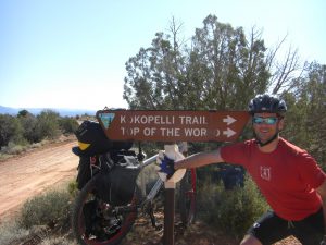
The morning went by pretty smoothly. We were passed by a number of jeepers and a few high-end SUVs sporting official Utah logos on their doors. We also rolled past a number of groups camping along the road. There didn’t seem to be any designated spots, but there was still room for a tent or camper along the ride at various wide pull-outs. Eventually we stopped for a snack break next to a nice sign. Throughout the trip, I looked for stopping places that would allow me to prop up the bike. It was so heavy, it was difficult to lay down and pick up again. While we were snacking, a gaggle of dirt bikers rambled through the trail. They didn’t slow down and sprayed dirt and rocks all over, making them easily the most annoying bunch of people we encountered along the trail.
Barely back under way from our snack stop, I suffered the first (and only) significant mechanical of the trip. After a poorly executed shift, I lost the chain. I think it actually broke at the master link, which isn’t supposed to happen. I’d broken the chain the previous summer riding up in Nederland. At the time, I’d given it an impromptu trailside fix by removing a link and pushing a pin back into place to keep it all together. I’d been riding with a spare chain in my Camelback® ever since—just waiting for this moment! In addition to the chain, I had a spare master link with me as well, but I chose to replace the entire chain. I’m pretty quick, so with Pete holding the bike right-side-up, I was able to resize and install the new chain in under 5 minutes.
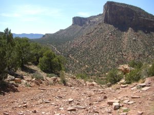
The riding continued through some spectacular scenery. This was definitely the day of endless canyon riding and scant shade. OK, I admit it, every day featured scant shade. Just as I was starting to think that water was going to be an issue, a family pulled up in a Jeep and handed us a bottle of fresh water. It was an odd experience. We hadn’t asked for anything; Pete said something about divine providence. I don’t know about that, but it was cool and delicious. In hindsight, it may have caused me to drink my water even faster, but it felt a little like salvation at the moment.
Not long after replacing my chain, I discovered I was suffering from a bit of skipping. This can happen when you wait too long to replace your chain. It “stretches” and begin to wear out the cogs on your cassette. Then, when you put on a nice new chain, the worn teeth on the cogs cause it to skip under moderate pedal forces. There were a few large gears on the cassette that seemed to work reasonably well, so I decided to push on rather than try and repair the old chain.
After another mile or two of climbing, we came to the day’s first short downhill section. It was a rough stretch of fun singletrack. Pete and I took turns shooting shaky videos of each other bombing through the descent. As always happens, the descent eventually turned into a rough climb. Mostly it was rideable, but there were a few stretches of short hike-a-bike. When we reached the top, we rejoined the road. A quick look at the map, and we were totally confused. Apparently my map is a bit out of date, and that was the reason for our confusion. We were clearly still on the right road, so we just pushed on.
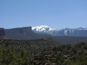
A few curves later we rewarded with some great canyon scenery, and we caught another glimpse of the La Sals. We hadn’t seen the mountains since the previous afternoon, so when they appeared, it was an awesome sight.
About the time the mountains reappeared, I sucked my bladder dry. That was the end of my day’s water. This was a real problem, because we were only nearing the end of the day’s first climb. At that point, Pete had less than 1 bottle of water remaining as well. He offered me some of his water, but I refused. We navigated a short, but super steep, section of singletrack that dropped us about 200′ and then climbed back up the opposite side of a narrow ripple. Upon reaching the far side, the first climb was essentially done. I heard some dirt bikes off in the distance and watched for a while hoping to see them ride what we’d mostly just walked, but they must have been traveling a different direction. We descended for a couple of fun and fast miles until we reached the junction with Onion Creek Road.
At the Onion Creek Road junction, we had a big decision to make. We were both essentially out of water, and sitting roughly at the bottom of the day’s 2nd, and larger, climb. Basically we had three options. We could just keep riding the trail and hope we found some water. We could take an unlikely shortcut comprised of dirt roads across the upper Fisher Valley that eventually climbed at least 1000′ in the final half mile. Or we could ride down Onion Creek Road to highway 128 and then take the highway to Castle Valley Road. The last choice was definitely the longest. I estimated we had about 16 miles by trail, perhaps 8 miles via the shortcut, and around 25 miles if we chose the road option. With our water situation, none of the options were ideal.
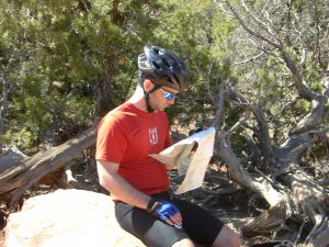
We picked the shortcut option first. Pete thought he had some iodine tablets in his backpack, and the trail was passing right next to fenced-off cattle ranch. The map also showed a couple of intermittent streams, so we figured if they were ever flowing, mid-April would be the time. We followed the road/trail for a mile or so until we came to a junction. One direction was gated and marked as a private road. The other indicated it was a public road, but that it was a dead end. Did that mean that bikes couldn’t get through either? Pete road ahead a short distance to see if the stream would appear so that we could grab some water. I ate some nuts and raisins and laid down along the roadside to grab a little rest. At this point it was super hot, so I used the map as a sunshade.
Pete returned triumphantly with two bottles of water; however, the excitement was short-lived. After a search through the backpack, the iodine tablets were nowhere to be found. We decided not to drink the suspect water, but used it to cool ourselves off by dousing our heads with it. It was a very sad moment. Definitively out of water and with little hope for resupply, I decided we should ride the road option. It was the longest, but seemed the safer route if things took a turn for the worse. In hindsight, I’m sure we’d have reached camp, and reliable water, much sooner if we’d taken either of the alternative routes, but the Onion Creek Road descent would prove to be super fun.
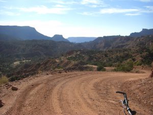
As we stared down the beginning stretch of the road, Pete remarked that it looked like the Great Wall of China. Riding down the road was a bit like an old wooden roller coaster. Some of the curves had cool banking that allowed for some crazy maneuvering. We shot a bunch of fun videos as we shot up and down little hills along the road. At one point, I captured 2 minutes of the worst video ever as I tried to attach the camera to my chest. I should have realized that when I bent over to grab the handlebars, all the camera would see was my hand as the road rushed by at phenomenal speed. We watched the little clip and had a good laugh. My commentary was especially funny as I described what the camera wasn’t seeing.
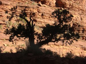
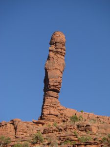
As we approached the bottom of the canyon, we began riding up to stream crossings. At first it was a refreshing and cooling change of terrain, but after about the tenth crossing, we were getting a little tired. My shoes were completely soaked. By now, Onion Creek was taking on a distinct sulfur smell, and we were regularly rolling past campers taking advantage of wide shoulders along the road. We also started to see some of the classic Fisher towers. It seemed like the canyon would never end, and our constant photo stops didn’t help much.
As we were nearing the bottom, I spotted a guy who seemed to be breaking camp. I decided to take a chance and see if he had any spare water. He was reluctant, but offered up a little bit. Pete and I both grabbed a little bit, but it was clear it wouldn’t last us long. About a mile later, we were back on the highway. Pete had 1 bar on the cell phone, so he called in to give Kelli an update. We told her about our detour just in case Jess happened to call, and continued on towards Castle Valley road.
From the bottom of Castle Valley road, it was still another 10 miles and 2000′ of climbing to reach the Rock Castle campground where we were planning to meet Jess. I wasn’t entirely sure if she’d be there, or if our friend Elijah would be with her. I’d wished there was some way to let her know we’d be a good bit later than we’d planned, but even if she’d had a cell phone, it wasn’t likely she’d have service. As we set off up the hill, I was in the lead, but I knew Pete would pass me soon. I was pretty much out of energy, so I told him not to bother waiting for me. Somehow I lost the cleat from my left shoe along the road. This reduced me to walking quite a bit, but I think I was making equally good time. I stopped for a while to take pictures of the sunset back down the valley.
As night fell, I could hear the coyotes howling all around me. I later learned that one walked right up to Pete. I’m glad I just heard them. I pulled my headlamp out of the bag. In a way, I was glad to finally have a chance to use it. I could see Pete’s light up ahead. It was hard to estimate, but I suspected he was no more than a mile or so up the road. A while later, I had a bit of a 2nd wind and was riding reasonably well, when a car approached and stopped in front of me. It was Jess coming to rescue me! Apparently I was described as spiritually broken, but I wasn’t quite that bad off. I was actually pretty close to the campground. I’d been checking every little dirt road, in case it was the turn.
Jess helped me put the bike onto the roof, and handed me a large jug of water. It was some of the best water ever! In just a couple of minutes we were back to camp where Elijah was busily reheating the homemade Indian food that was dinner. I finished the water and had a lovely porter from Deschutes. Like the water, the beer too was exceptional. Pete was telling me that he missed the turn for the campground and continued up the road until he found the trail junction. He was just about to give up on finding the campsite when he spied the tiny tent sign that marked the way. They really hide these campsites along Kokopelli’s Trail. We sat around the nicest campfire for a bit before heading off to sleep. We thought this would be the make-or-break day of the trip, and I guess it was a little of both.